

GPS Anti Spoof app for iPhone and iPad
Developer: Frank Reed
First release : 16 Jun 2019
App size: 22.39 Mb
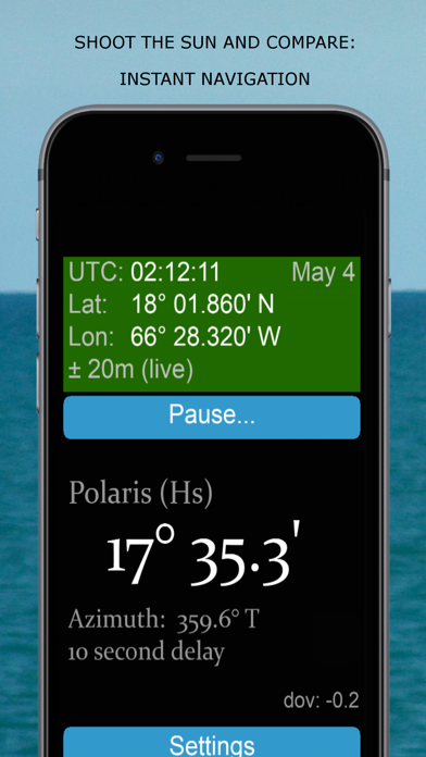
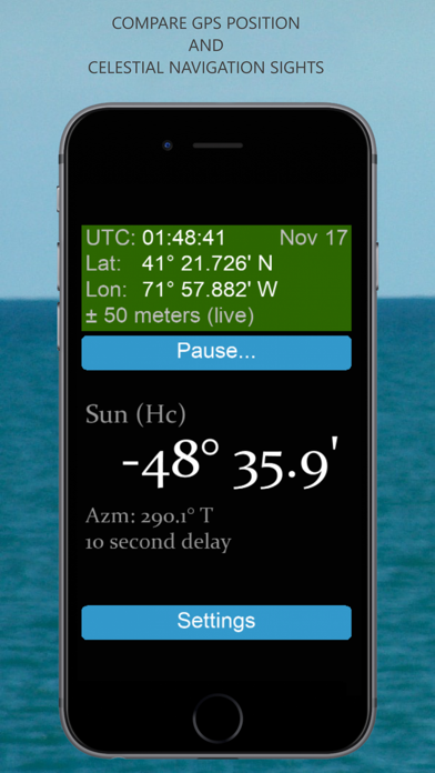
Instantly compare observed celestial navigation altitudes with high precision, live calculated altitudes. Shoot the Sun, tap pause in the app, and get instant feedback.
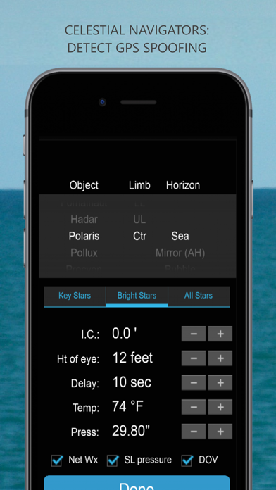
Standard version includes data for the Sun, Venus, and two stars. The Pro version of the app is for serious navigation use and includes data for the Sun, Moon, Venus, Mars, Jupiter. Saturn. the 57 standard navigational stars, plus Polaris. Both versions function off-network and at sea however the standard version only works for three days off-network. The Pro version can function for weeks in the middle of the ocean without network access.
This app calculates the exact altitude that should be observed in celestial navigation at sea or on land assuming that the GPS position is correct. No paperwork is required, no tables of corrections. All corrections are included automatically: index error, system time error, dip of the horizon, refraction, temperature and pressure corrections to refraction, altitude above sea level, parallax, and also gravitational deflection of the vertical (a correction of up 2 nautical miles not handled by any other celestial navigation sight-clearing product) are all included automatically. If the GPS position is wrong, due to Spoofing at sea, observations will not match. With this app and occasional quick sextant sights, mariners can reliably detect GPS spoofing.
No GPS Spoofing? The app also functions as a celestial navigation trainer: take a sight and immediately compare against the apps display. No paperwork and instant feedback will improve celestial sextant skills in hours instead of days or weeks.
The app works off-network, even in the middle of the ocean. If a network connection is available, the app will download temperature and pressure information automatically. Or weather data can be entered manually, if desired.
The ephemeris data is generated from the same JPL numerical integrations of lunar and planetary motions used by the official Nautical Almanac and Astronomical Almanac. All coordinates are accurate to one second of arc, and displayed altitudes are accurate to a tenth of a minute of arc.